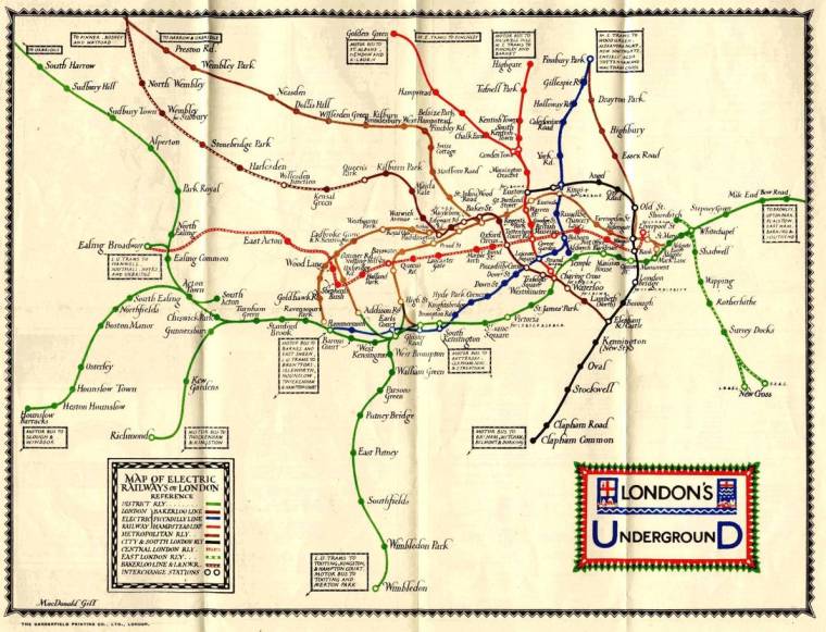
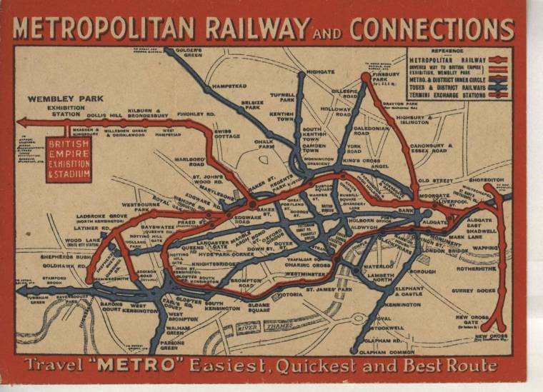
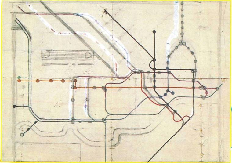
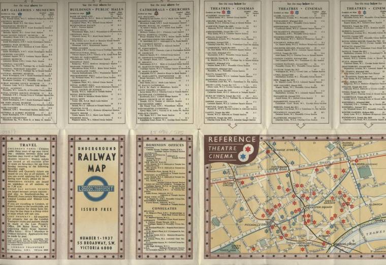
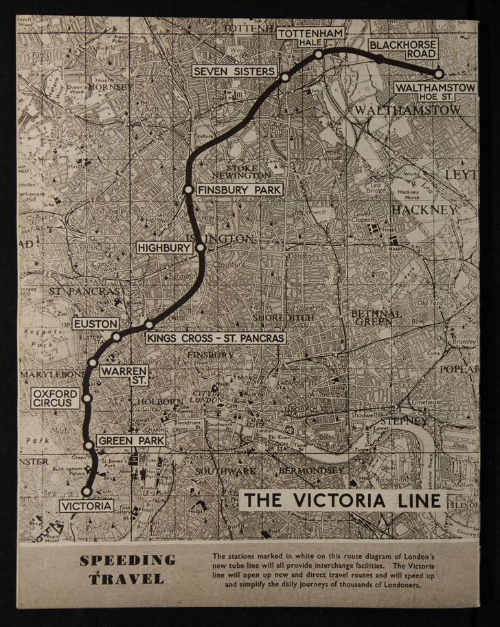
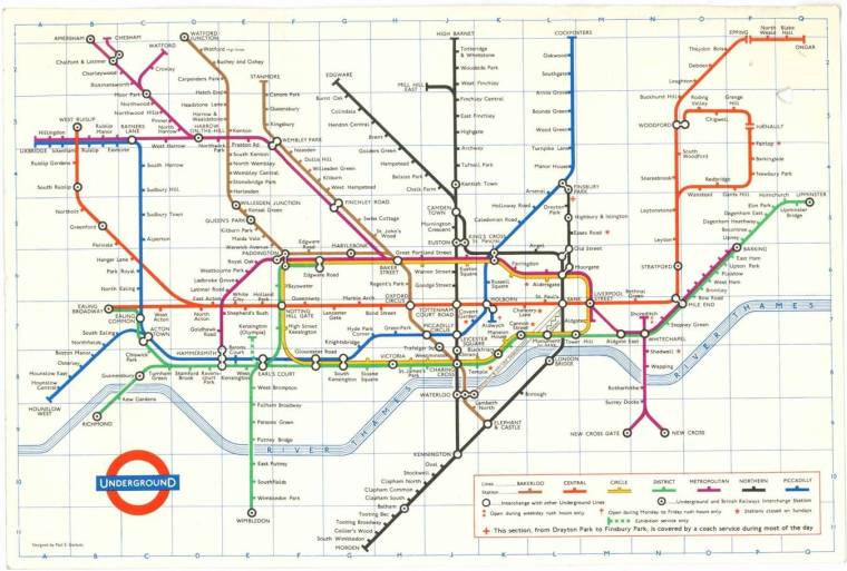
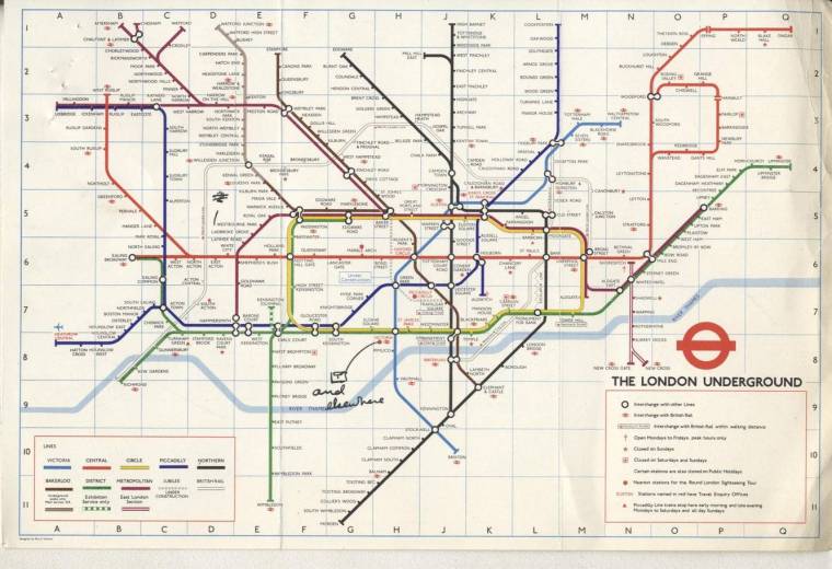
Designers’ hand-drawn diagrams were largely based on the real geography of the Tube lines, which resulted in far more chaotic-looking maps (Published 1925)Prior to 1906, the individual railway companies produced their own maps and focused on their own lines (Published 1925)Henry C Beck’s design was initially dismissed for being too revolutionary (Created 1931)The maps show how the ever-expanding Tube system and railways were previously depicted, often using free-hand drawings and calligraphy (Published 1937)The Victoria Line, which was opened in March 1969, shows the route from Victoria to Walthamstow (Published 1962)The historic diagrams provide a fascinating insight into the development of the capital’s famous Underground since it first began operations in 1863 (Published 1966)This map from 1978 announced the arrival of Heathrow Central underground station (Published 1978)